Waitlist open · launching autumn 2026
End to end, in your language

Hike Korea like a local.

Subway to summit to last train home.
English trail guides. Offline GPS. Real-time safety alerts.

See how KoreaPeak works · choose language to dinner

Hiking in Korea isn't hard. Getting there is.

01

No English trail signs

Trail markers are Korean-only. Get lost or guess.

02

Can't reach the trailhead

Which bus? Which subway exit? No English transit info.

03

No safety info in English

Weather alerts, trail closures, emergency contacts · all in Korean.

Your whole hike, end to end

Subway home, last train, English menus · not just the trail.

  • Offline trail maps with GPS
  • Real-time safety alerts (weather, closures, wildfire)
  • Subway-to-trailhead directions
  • Nearby restaurants with English menus
KoreaPeak mountain detail: today's safety verdict and the full city-to-summit-to-home plan
Safety

Know it's safe before you go

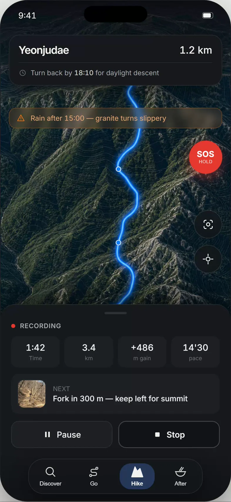
Real-time weather, trail closures, and a clear go/no-go call for today · plus one-tap SOS that shares your live location. All in English.
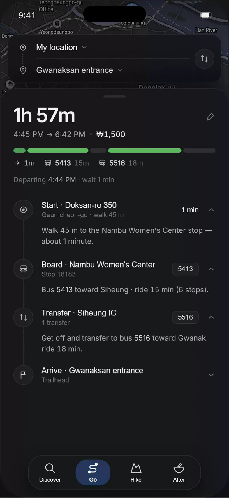
KoreaPeak trail navigation showing a weather safety alert and one-tap SOS
Getting there

From your door to the trailhead

Subway and bus directions straight to the trailhead, then offline GPS on the mountain. No more guessing which exit, which bus, or where the path begins.

KoreaPeak transit directions from the city to a Korean trailhead
Real-time OCR scan

Point your camera, read Korean instantly

Trail signs on the mountain, menus after the hike · scanned and translated to English on the spot.

Trail-sign scan · OCR
Menu scan · OCR

Be the first to hike Korea the right way